
On a very wet and windy morning in October just before the second English lockdown Catherine met with Susan Woodward from ‘Coal Mining in Leicestershire’ and retired mine workers Colin Harris and Nigel Mansfield at Bagworth Heath Country Park, the site of Desford Colliery.
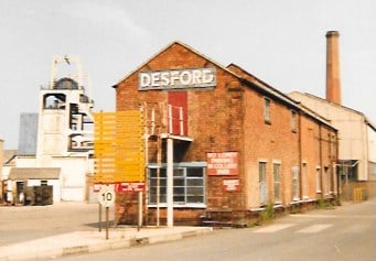
Desford Colliery was developed by E. Edward Bramell in 1900 for the Desford Coal Company. It was worked for house and steam coal. It survived nationalisation in 1947 and remained operational until closure in 1984. At its peak, 1492 men were employed underground, with 390 surface workers and max output reached over 1 million tons in 1954 (1,081,762 tons). The surface buildings were demolished and the site initially reclaimed by British Coal in the early 1990s and Leicestershire County Council between 1997 and 2000.
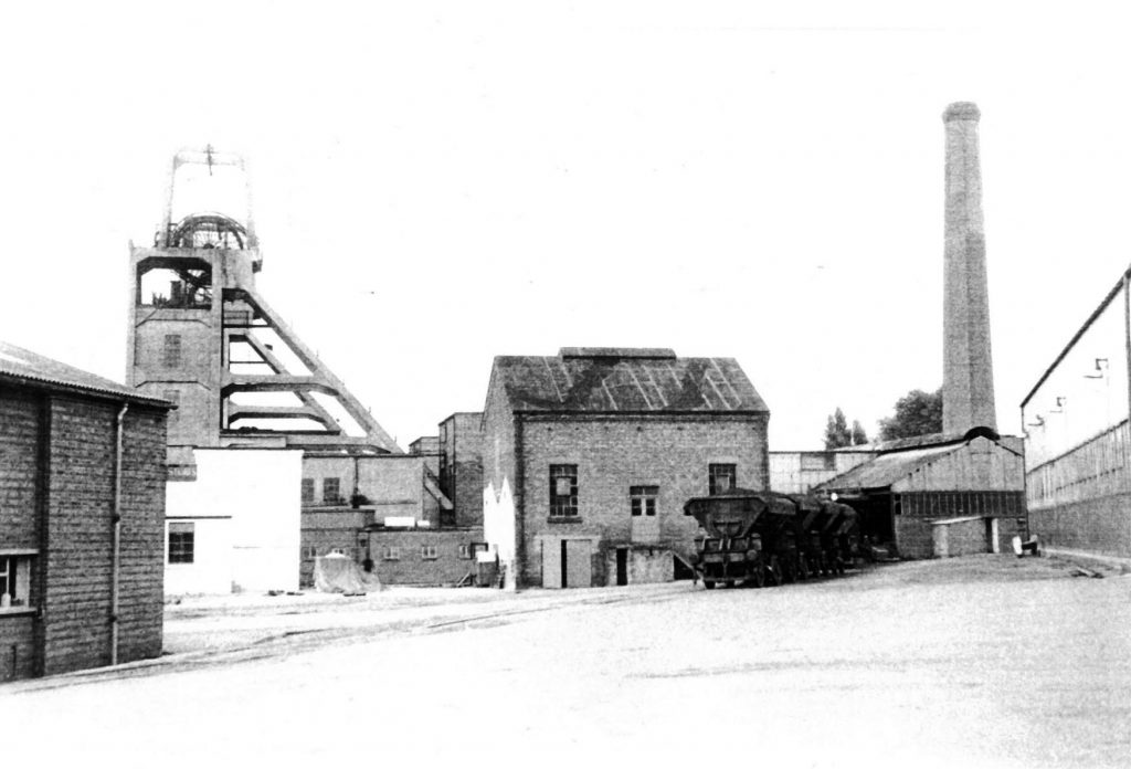
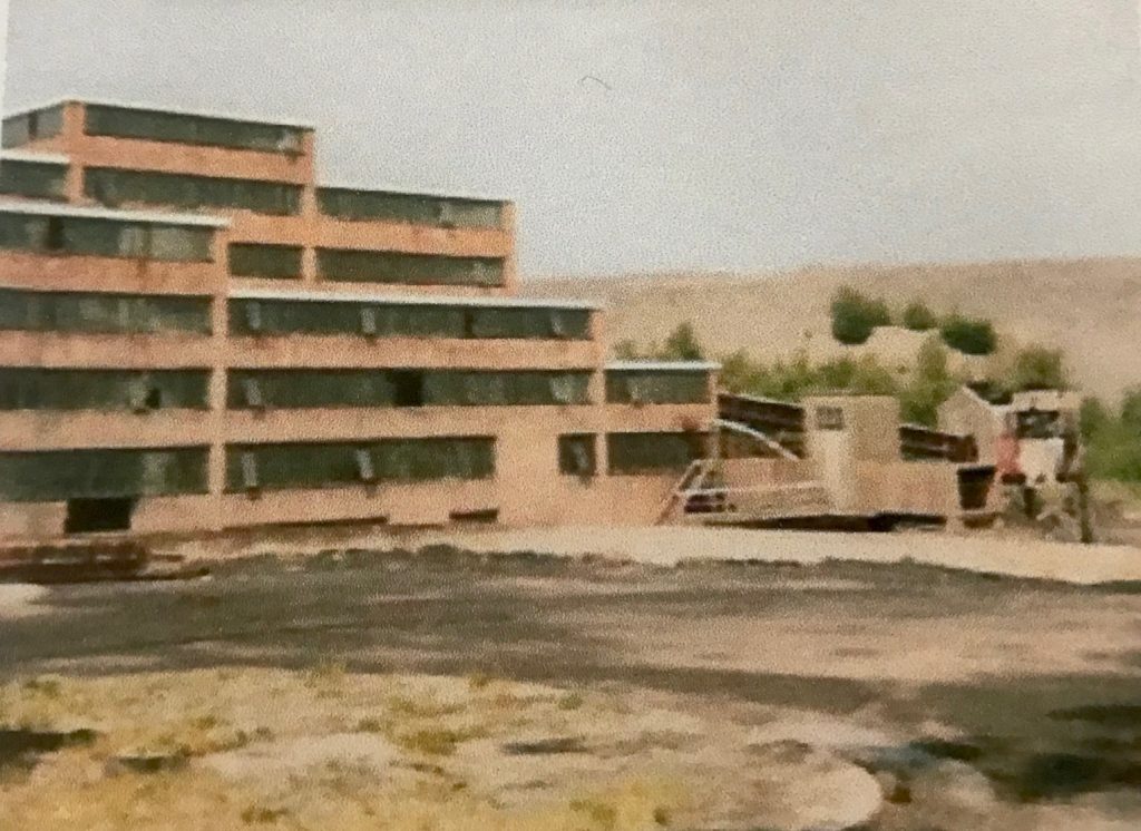
General view of colliery showing the headgear at No.2 (upcast) Shaft. Side-tip wagons with coal for the boilers. ©G. Hayes (1973) Sourced from https://www.nmrs.org.uk/mines-map/coal-mining-in-the-british-isles/leicestershire/desford-colliery/
The colliery is the home of the ‘Desford Chock’, the first hydraulic chock, invented by Matthew Smith the under-manager and subsequently developed by Sam McKee, the mine agent. Its other claim to fame is the Desford Colliery Brass Band. Founded in 1898, the Band has numerous championship titles and starred in its own successful fly on the wall TV documentary ‘The Real Brassed Off’ in 2002.
http://www.desfordcollieryband.co.uk/
The key aim of the visit was to walk over the site with a view to creating a route on the app. Although the Landscape Legacies of Coal project has a Scottish emphasis, the actual app has worldwide coverage and we have expanded well beyond our original focus on Clackmannan and Stirling into the wider Scottish Central Belt. To date, Catherine had resisted expansion south of the border largely due to time and travel constraints. This time, however, it was impossible to say no. Catherine grew up on the fringes of the Eastern Basin of the Leicestershire Coal Field, she went to school at Desford (same as Susan) and Catherine’s mum lived for several years down the road from the neighbouring Merrylees pit which eventually connected underground to Desford from the mid-1960s. Once the reserves had been exhausted at Merrylees, the drift was used for additional pumping and ventilation.
Susan’s dad worked at Bagworth and her grandad worked at Nailstone, and she is very passionate about keeping coal mining alive in Leicestershire and getting both young and mature to connect together to find out about their heritage and how their local communities have been shaped by the industry. She set up the ‘Coal mining in Leicestershire’ project initially as a Facebook group and now has a social media following of around 2000.
See https://twitter.com/coalmininginle1
https://www.instagram.com/coalmininginleics/
https://www.facebook.com/coalmininginleicestershire/
There is also a website in the early stages of development which will have lots of information on the local collieries along with a remembrance page dedicated to all the ex-miners of Leicestershire.
https://coalmininginleics.wixsite.com/website
The motivation behind the Leicestershire Coal Routes was because Susan wanted to see more information about where the collieries were, what they looked like, how they operated and shaped the communities, particularly as local people who had just moved into the villages were asking more about them. She hopes that the local walks interpreting the sites will help people connect with the story of the Leicestershire Coalfield.
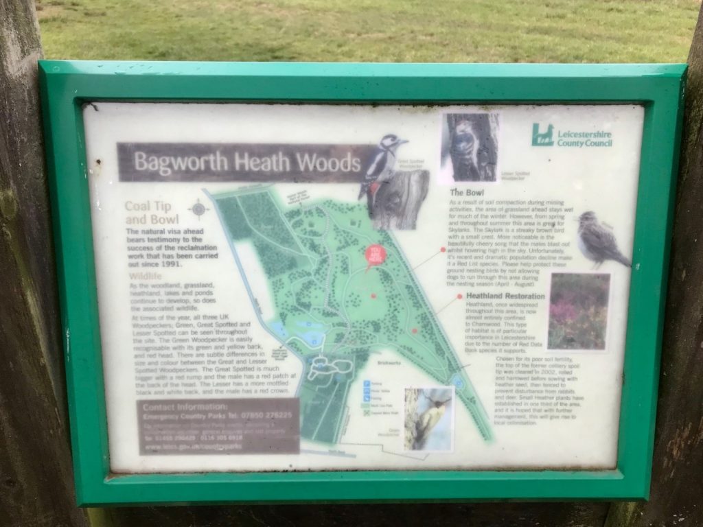
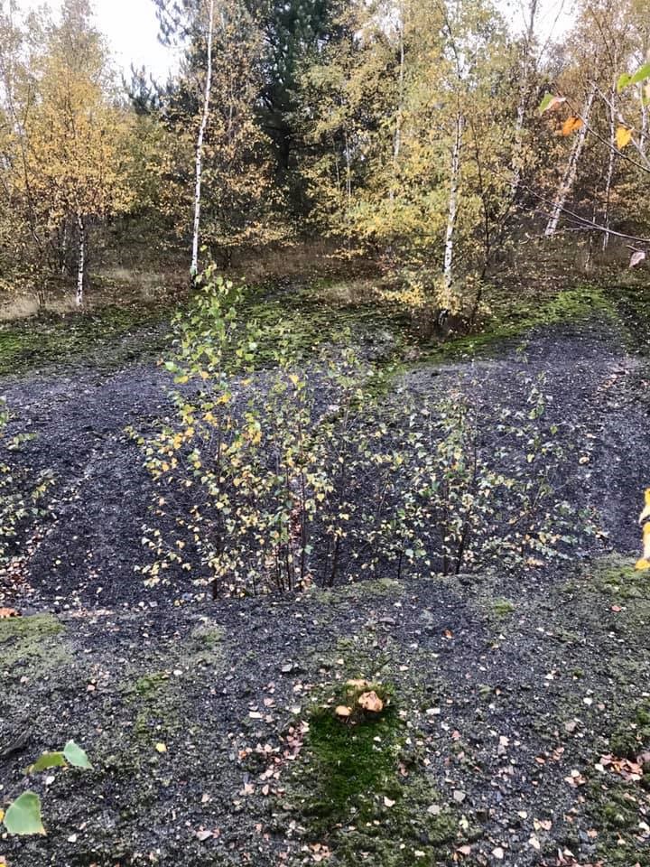
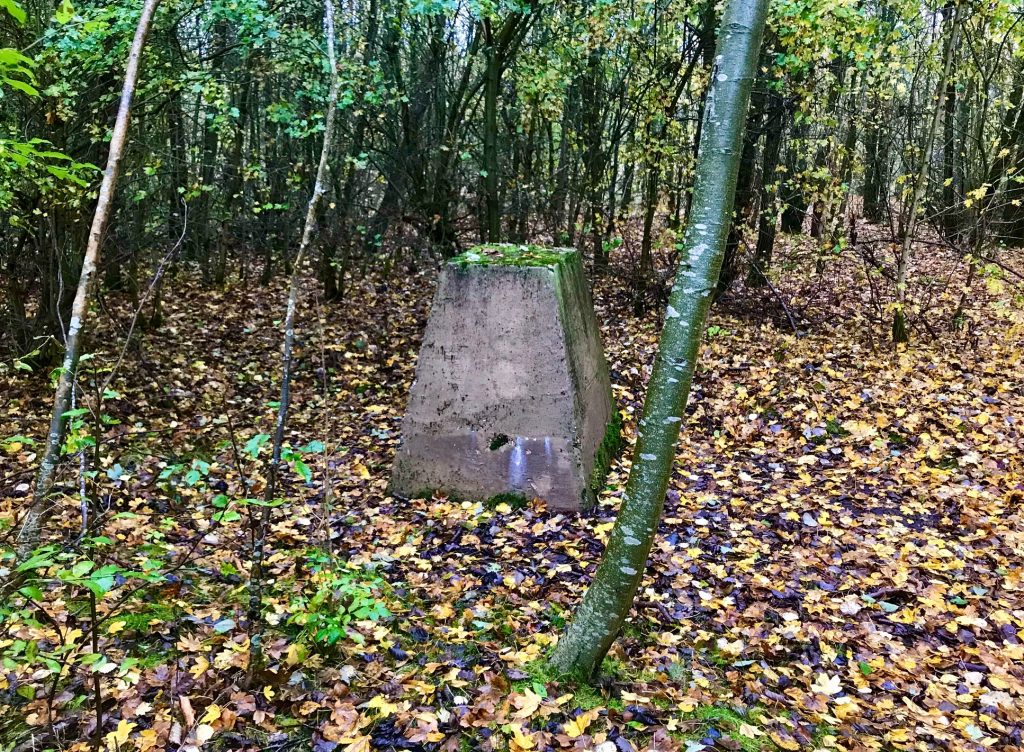
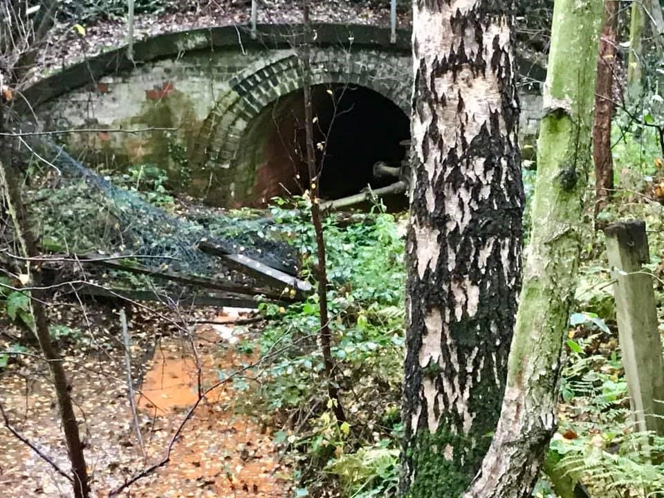
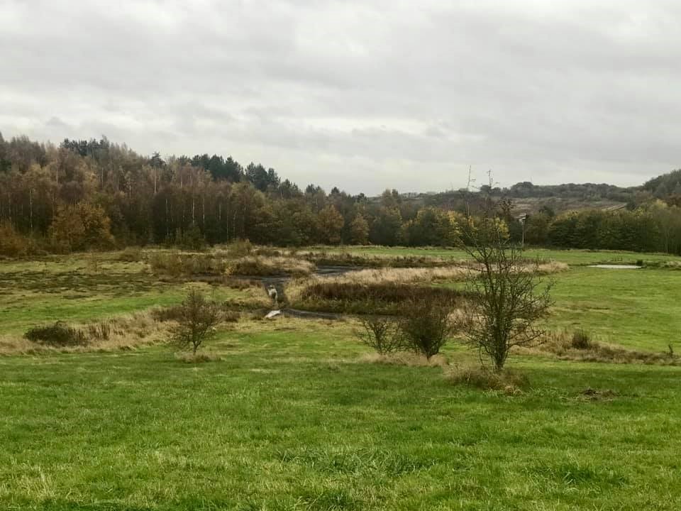
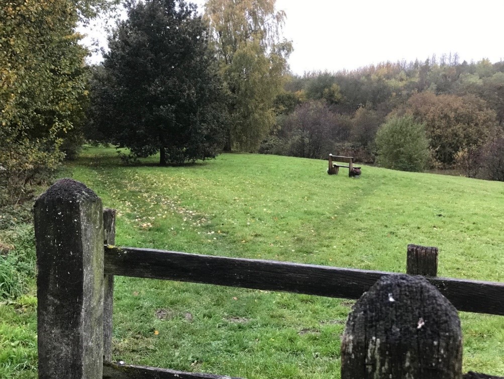
Desford is a great site, despite dramatic changes to the landscape there is still much to see in terms of surviving footprints in the landscape including the two capped shafts, the bing (much reduced in size), the route of the mineral branch line serving the colliery (Leicester to Burton railway), evidence of subsidence and acid mine drainage. The subsidence flashes resulted from the neighbouring Bagworth pit robbing the support pillars when the colliery closed. They were repurposed to create three lakes and a wetland habitat by British Coal as part of the remediation programme in the early 90s.
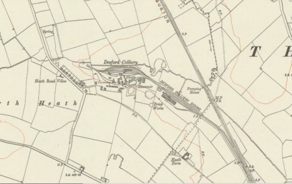
The site, as you can see from the historic map below, was fairly extensive and it was great to have Colin and Nigel with us on the walk as they were able to pin point what was where which means we will be able to do a series of ‘before and after points’ on the route, such as the location of the coal preparation plant commissioned in 1955 as part of a £1m reconstruction scheme and the pithead baths constructed in 1953. The brickworks (now operated by Forterra) continues in operation.
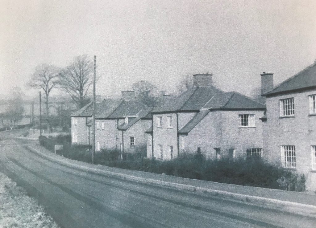
The route will also include the social landscape, the colliery had a sports ground and pavilion and its own housing at Desford Colliery Village, where Colin used to live (demolished in the 1980s).
Although much depends on Covid restrictions, we are aiming to have the route ready for walking early in the New Year. The longer term plan is to expand coverage to the Bagworth and Nailstone Collieries.
Catherine Mills and Susan Woodward, November 2020.